
Strengthening health supply chains in Malawi
At Swoop Aero, we believe in equitable access to healthcare for all. That’s why we’re working to bridge gaps in Malawi’s health supply chains and deliver better patient experiences and outcomes in remote communities


The challenge
Accessing the right healthcare, at the right time, can be a significant challenge for Malawians – particularly for those living in remote areas. Essential, and sometimes lifesaving, medical deliveries must be transported across vast distances and challenging terrains.
Rivers and lakes, as well as flooding and slippery earth roads during the rainy season from April to November often leave critical pathways impassable. Deliveries between central hospitals and remote health centres can take hours, or even days, by motorcycle, car, and boat.
There are a total of 3 million people in districts across Southern Malawi, serviced by 100 health centres. Riders for Health, a motorbike network, travels through these conditions to service each health centre twice a week, transporting 50 vaccines or 3kg of medical supplies and pathology samples. Fuel shortages and weather conditions cause frequent delays to this essential service, and road closures during the COVID19 pandemic added further delays.
Delivery delays are a significant contributing factor to one in five patients not receiving their pathology test results within 3 months.
Consequently, prevalent communicable diseases such as HIV/AIDS, tuberculosis, and neonatal conditions, go undetected. This has profound implications for the health, wellbeing and disease burden experienced by communities throughout Malawi.
When natural disaster strikes, routine and emergency medications and vaccinations, and diagnoses and subsequent treatment, are placed further out of reach for more people. This was evident in 2023, when Tropical Cyclone Freddy brought widespread and devastating flooding and landslides to Malawi – all amidst a cholera outbreak.

Our response
When a mother in labour needs emergency medicine, or when vaccination can protect children in a polio outbreak, a fast response can make all the difference.
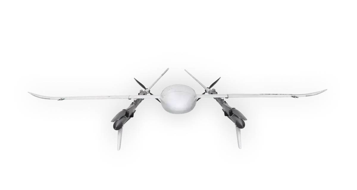
We’re rapidly integrating a network of Swoop Aero autonomous aircraft Kite and software across Malawi’s health supply chain. This is helping to place essential health supplies and services within fast and easy reach for everyone, no matter where they live.
Our expanding network is among the world’s longest-running drone logistics operations and is forging much needed agile, reliable and cost-effective connections between hospitals and remote health centres.
The network services district hospital catchments in:
- Nsanje
- Chikwawa
- Zomba
- Balaka
- Machinga
- Mangochi
- Chiradzulu
Expansion is planned to include:
- Neno
- Mwanza
- Ntcheu
- Thyolo
- Mulanje
- Phalombe
- Blantyre
- Mzimba South
- Nkhata Bay
Bridging gaps together
We collaborate extensively to unlock the skies for the good of us all. This timeline traces how we’re working together in Malawi for a future where good health and wellbeing is always within fast, easy reach.
2019
- Commenced operations of the USAID Global Health Supply Chain Procurement and Supply Management project, Nkhata Bay district – northern Malawi.
2020
- Delivered a 10-month medical delivery and disaster relief project with UNICEF and UKAID, Nsanje and Chikwawa districts – southern Malawi.
- Tripled our operational fleet and continued operations through the pandemic, supported by remote piloting from Swoop Aero HQ, Melbourne.
- Expanded into southern Malawi with VillageReach.
2021
- Launched ongoing work with Malawi’s Ministry of Health and VillageReach to advance humanitarian and development activities.
- Worked with Focusing Philanthropy and UPS to expand the network.
- Became one of the world’s first air logistics companies to transport WHO-approved malaria vaccines.
2022
- Launched research, with VillageReach and IDinsight, to investigate the impact of drone logistics on population health, funded by USAID.
2023
- Continued to deliver and expand day-to-day operations, with the support of USAID.
- Continued to grow our Malawi Crew – we now have 17 full-time local employees.
- Supported Malawi’s cholera outbreak response by transporting patient cholera samples through our established day-to-day operations. In August 2023, the Malawi Ministry of Health declared that cholera was no longer a public health emergency.
- Successfully delivered a polio vaccination campaign with UNICEF to remote areas.
- Adapted established medical delivery drone logistics infrastructure to support, where possible, the Tropical Cyclone Freddy response. This included assisting UN agencies, including UNICEF, to identify flooding and infrastructure damage in certain districts.
- Ongoing contribution to institutional review and conversations around learnings from Tropical Cyclone Freddy, preparedness for the future, and how drones may be leveraged in crisis management.
- Disaster resilience preparations in Bangula, Malawi alongside humanitarian agencies with the Ministry of Health Malawi, Department of Disaster Management Affairs, and the UN World Food Programme.

Our impact
Our networks are strengthening Malawi’s health supply chains for equitable access to emergency and routine healthcare. We’re delivering fast and reliable medication, vaccination, testing, diagnosis, and treatment to improve and save lives.
Essential supplies and services delivered
Reach
Efficiency

Nsanje District Hospital to Makhanga Health Centre
Time saved: 6.5 hours
Transporting medical supplies from the Nsanje District Hospital to the Makhanga Health Centre involves a 6 hour drive, then a 20 to 30 minutes boat trip, and finally up to a motorbike ride of up to 30 minutes. With Swoop Aero, this journey of around 7 hours is reduced to just 30 minutes.
Mangochi District Hospital to Makanjira Health Centre
Time saved: 6+ hours
In the Mangochi district, roads are so challenging that it takes seven hours to transport medical supplies by road from the district hospital to the Makanjira Health Centre. In contrast, with Swoop Aero, this journey takes only 45 minutes.
Zomba Central Hospital to Chisi Island
Time saved: 1.5 hours
Transporting medical supplies from Zomba Central Hospital to Chisi Island, located in the middle of Lake Chilwa, involves driving for close to an hour – then another hour or more by boat, depending on the water current. This journey is cut to less than 30 minutes with Swoop Aero.
Interested in flying with us?
We’d love to hear from you. Explore how we can help you to unlock the skies for medical transport, emergency and natural disaster preparedness and response, monitoring and mapping, retail deliveries, and more. The sky is not the limit – it’s just the beginning.


